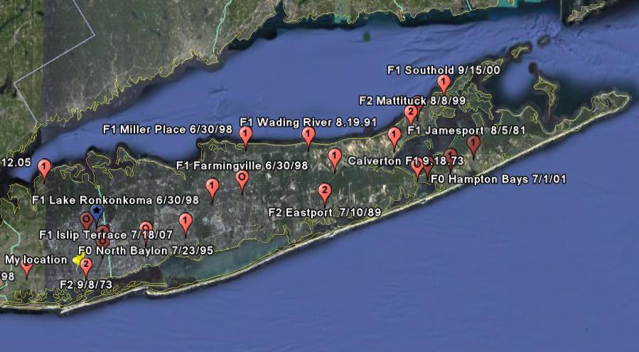
LONG ISLAND TORNADOES
F0 TORNADOES
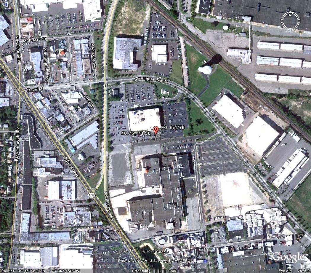
Bethpage June 1,1973
Click on image for larger view
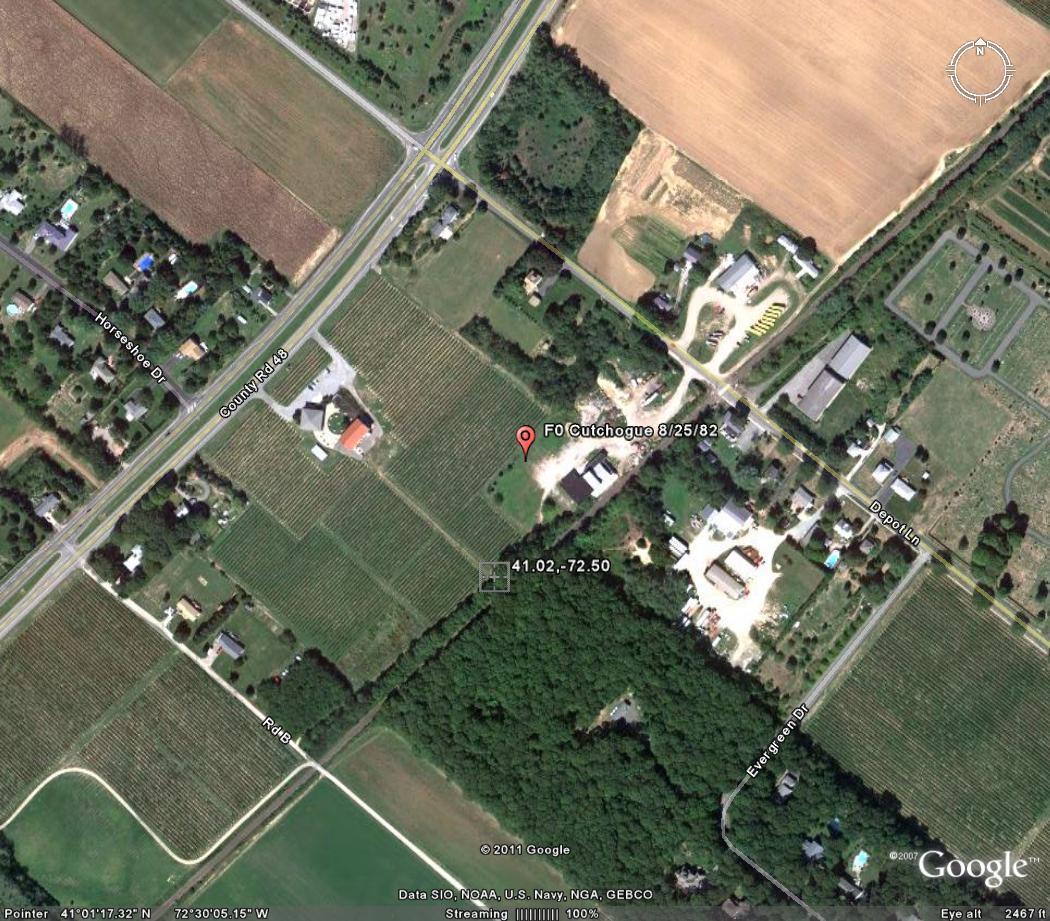
Cutchogue August 25,1982
Event: Tornado
Begin Date: 25 Aug 1982, 1400 CST
Length: 0.50 Mile
Width: 13 Yards
Magnitude: F0
Fatalities: 0
Injuries: 0
Property Damage: $ 0.0K
Crop Damage: $ 0.0
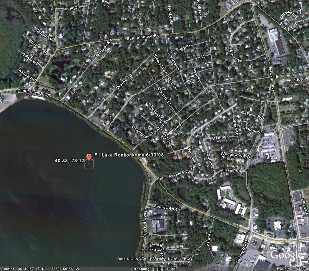
Selden June 30,1998
Event: Tornado
Begin Date: 30 Jun 1998, 07:20:00 AM EST
End Date: 30 Jun 1998, 07:20:00 AM EST
Length: 0.10 Mile
Width: 100 Yards
Magnitude: F0
Fatalities: 0
Injuries: 0
Property Damage: $ 0.0
Crop Damage: $ 0.0
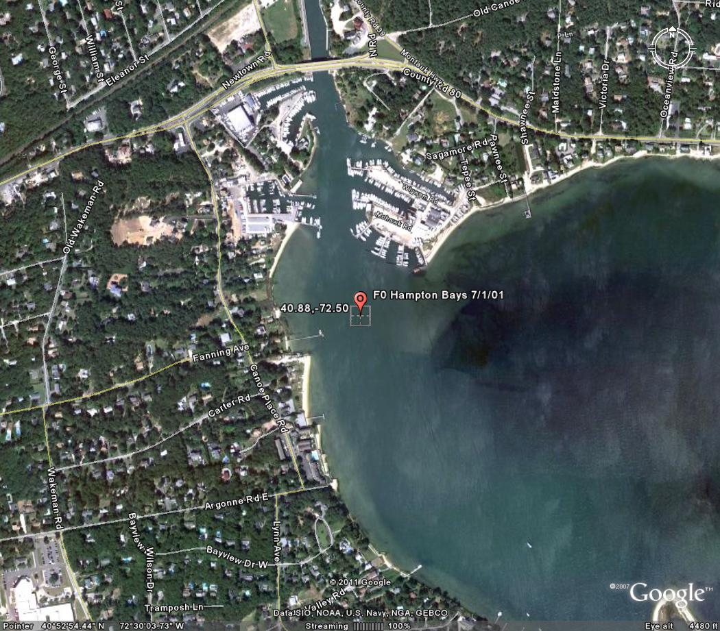
Hampton Bays July 1,2001
On June 30th, two "waves" of severe weather occurred: the first during the morning and the second during the evening. The first wave included an isolated severe thunderstorm that spawned two weak tornadoes, large hail, and damaging winds as it moved across Central Suffolk County. The first tornado (F1) touched down along Lake Shore Road, south of Portion Road in Lake Ronkonkoma. It downed several large trees and power lines. Trees were blown into houses and caused structural damage. This tornado then lifted and funnel clouds were observed before another touchdown (F0) occurred on the campus of Suffolk Community College in Selden. Numerous trees were uprooted and fell on cars and wires on the campus. More tree damage occurred along Middle Country Road and Mooney Pond Road in Selden. The first wave also included a line of thunderstorms that moved east across Orange County. Thunderstorms produced high winds that downed trees in Goshen and Chester. A funnel cloud was also observed between Goshen and Chester. The second wave included lines of severe thunderstorms that produced high winds, large hail, and frequent lightning. This resulted in widespread damage across the region. In Orange County, high winds downed many trees and power lines. Significant damage to trees and houses occurred in Monroe and Newburgh. High winds also blew a trailer upside down on Bark Lane, off Big Island Road in Florida. Four people were injured and required medical treatment at Arden Hill Hospital. Lightning struck a house in Pine Bush, which ignited a fire and caused structural damage. In Rockland County, high winds downed power lines in New City and trees in Hillcrest and Stony Point. A tree fell into a hospital in Stony Point. In Westchester County, high winds downed trees in Peekskill and Yorktown. In Bronx County, hail damaged windows. In Queens County, high winds downed tree limbs that struck and injured 3 girls. One girl was seriously injured and required surgery. In Nassau County, 0.88-inch diameter hail fell in Jericho and 0.75-inch diameter hail fell in Oyster Bay. High winds downed trees and power lines. In Syosset, high winds blew off a roof from a house. In Suffolk County, an F1 tornado was confirmed in Mt. Sinai. The damage path extended from 114 Hickory Street to the corner of Marcy Drive and Westcliff Drive, then down Marcy Drive and across Chestnut Street. Several large trees were uprooted and damage to house shingles and roofs occurred along the path. Elsewhere in Suffolk County, high winds downed trees and power lines.
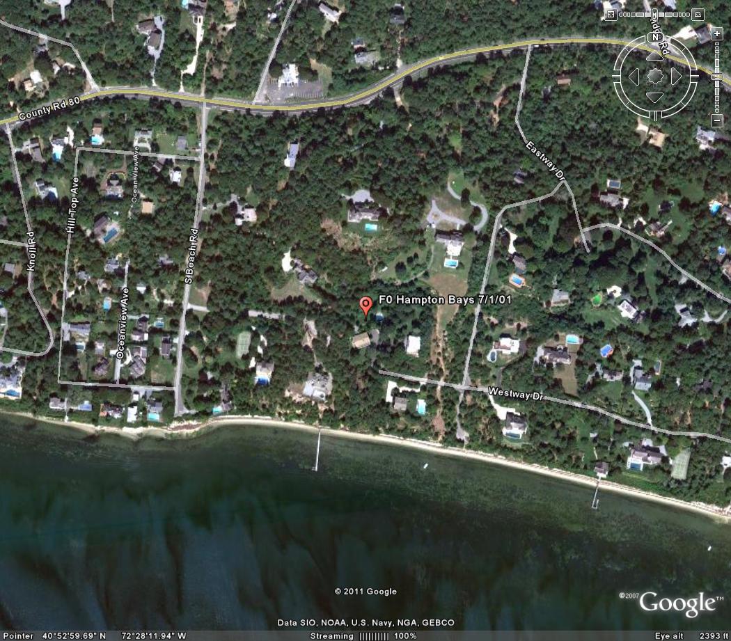
Shinnecock Hills July 1, 2001
Event: Tornado
Begin Date: 01 Jul 2001, 12:30:00 AM EST
Begin Location: Hampton Bays
Begin LAT/LON: 40°53'N / 72°30'W
End Date: 01 Jul 2001, 12:30:00 AM EST
End Location: Hampton Bays
End LAT/LON: 40°53'N / 72°30'W
Length: 0.10 Mile
Width: 50 Yards
Magnitude: F0
Fatalities: 0
Injuries: 0
Property Damage: $ 0.0
Crop Damage: $ 0.0
As a severe thunderstorm moved southeast at 40 to 50 mph, it produced a quick hitting microburst followed by a weak F0 tornado. The first report of damage occurred around 1:30 am EDT on Channing Cross Road near Newton Road in Hampton Bays. Several large trees were blown over. There was evidence of a suction vortex spinning around a funnel. The highest wind speeds occurred with the microburst, which were estimated from 70 to 90 mph.
Event: Tornado
Begin Date: 01 Jul 2001, 12:35:00 AM EST
Begin Location: Shinnecock Hills
Begin LAT/LON: 40°53'N / 72°28'W
End Date: 01 Jul 2001, 12:35:00 AM EST
End Location: Shinnecock Hills
End LAT/LON: 40°53'N / 72°28'W
Length: 0.10 Mile
Width: 40 Yards
Magnitude: F0
Fatalities: 0
Injuries: 0
Property Damage: $ 0.0
Crop Damage: $ 0.0
As the severe thunderstorm continued southeast, it spawned another short-lived weak tornado near Peconic Beach. On the property of the Peconic Beach Club, several boats were picked up and damaged. One small catamaran was picked up and blown through the side of a building. Several hundred pound umbrella stands were tossed around in different directions and metal fences around the tennis court were bent severely.
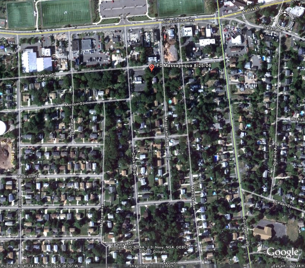
Massapequa August 25,2006
Event: Tornado
Begin Date: 25 Aug 2006, 11:00:00 AM EST
Begin Location: 1 Mile East of Massapequa Park
Begin LAT/LON: 40°42'N / 73°27'W
End Date: 25 Aug 2006, 11:05:00 AM EST
End Location: 1 Mile East South East of Massapequa Park
End LAT/LON: 40°42'N / 73°27'W
Length: 0.20 Mile
Width: 150 Yards
Magnitude: F0
Fatalities: 0
Injuries: 0
Property Damage: $ 0.0
Crop Damage: $ 0.0
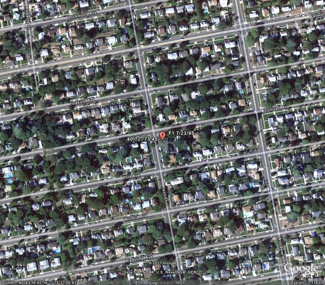
Heavy showers and thunderstorms produced flash flooding along many major roads, which resulted in road closures. The most significant flooding occurred along the Deegan and Cross Bronx Expressways, about 2 miles west of East Tremont in the Bronx; along Northern Blvd. of Jackson Heights in Queens; and along the railroad train tracks, Wantagh Ave. and North Jerusalem Road in Wantagh, where up to 3 feet of water submerged cars. Significant flooding, which resulted in road closures, also occurred in Yaphank. Up to 2.20 inches of rain was measured in Lake Grove. A severe thunderstorm produced a weak F0 tornado as it moved across extreme southeast Nassau County and extreme southwest Suffolk County between 12 Noon and 12:15 pm EDT. This was confirmed by a NWS Storm Survey team. The tornado's path length was only about one quarter mile long and its' maximum path width was around 150 yards. There was significant tree damage along its' path. Rotation was evident in the tops of many trees. The most damage occurred in East Massapequa between Merrick Road and Route 27A, Old Sunrise Highway. It was concentrated around Clocks Blvd. southeast across Melrose Ave. and County Line Road, then across Amityville's Old Fields and Homestead Avenues. The tornado lifted into the parent cloud before reaching South Ketcham Avenue. This severe thunderstorm produced damaging winds, large hail, and torrential rain along its' path. Large tree branches were downed in Wantagh. Quarter size hail was reported in Farmingdale. Flash flooding also occurred along its' path.
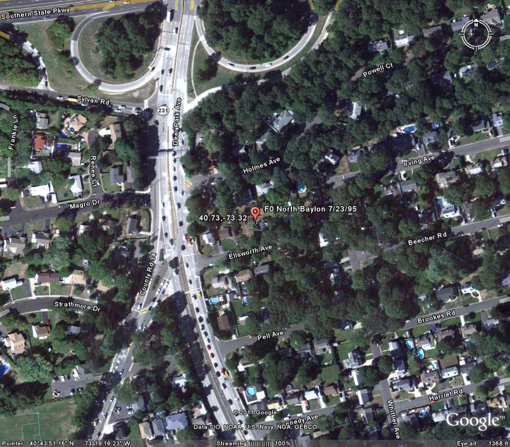
North Babylon July 23, 1995
Event: Tornado
Begin Date: 23 Jul 1995, 1746 EST
Begin Location: N. Babylon
End Location: Not Known
Length: 0.10 Mile
Width: 35 Yards
Magnitude: F0
Fatalities: 0
Injuries: 0
Property Damage: $ 500.0K
Crop Damage: $ 0.0
Strong thunderstorms moving across southeastern New York caused a variety of severe weather. Lightning, winds and heavy rains caused significant problems across the region. The severe thunderstorms also spawned a couple of tornadoes over Long Island. The first tornado skipped through the town of South Farmingdale, downing hundreds of trees and power lines. Many homes and cars were damaged before the tornado lifted back into the clouds. About 20 minutes later another weaker tornado touched down briefly in the town of North Babylon. A few trees were downed and some roofs were damaged.
PUBLIC INFORMATION STATEMENT
NATIONAL WEATHER SERVICE UPTON NY
833 PM EDT FRI AUG 25 2006
...WEAK TORNADO OVER SOUTH SHORE COMMUNITIES...
NWS INVESTIGATORS DETERMINED THAT AN F0 TORNADO TOUCHED DOWN IN
SEVERAL LOCATIONS OF EXTREME SOUTHEASTERN NASSAU COUNTY IN EAST
MASSAPEQUA AND EXTREME SOUTHWESTERN SUFFOLK COUNTY IN AMITYVILLE
BETWEEN 12 AND 1215 THIS FRIDAY AFTERNOON. WINDS IN A F0 TORNADO
ARE UP TO 72 MPH.
THE TORNADO/S PATH WAS ONLY ABOUT ONE QUARTER OF A MILE LONG AND
AROUND 150 YARDS AT IT WIDEST PART IN MASSAPEQUA. PREDOMINANTLY TREE
DAMAGE COVERED THIS AREA OF THE SOUTH SHORE. ROTATION WAS EVIDENT IN
THE TOPS OF MANY OF THE TREES AND TORNADIC DAMAGE CAME VERY CLOSE TO
THE GROUND IN SEVERAL LOCATIONS. THE MOST DAMAGE OCCURRED FROM
AROUND CLOCKS BOULEVARD THEN MOVED SOUTHEAST ACROSS MELROSE AVENUE
ACROSS COUNTY LINE ROAD INTO AMITYVILLE/S OLD FIELDS AND HOMESTEAD
AVENUES. IT SEEMED TO LIFT BACK INTO THE PARENT THUNDERSTORM CLOUD
BY THE TIME THE STORM MOVED OVER KETCHAM AVENUE.
THE PARENT THUNDERSTORM ITSELF WAS SEVERE AS WELL. WINDS WERE
ESTIMATED AT 60 TO 70 MPH. HAIL THE SIZE OF QUARTERS WAS ALSO
REPORTED WITH THIS STORM. VERY HEAVY RAIN ALSO OCCURRED WITH THIS
STORM CAUSING FLOODING OVER MANY SECTIONS OF NASSAU COUNTY AS WELL
AS SOUTHWESTERN SUFFOLK COUNTY.
A SEVERE THUNDERSTORM WARNING WAS IN EFFECT WHEN THIS STORM HIT THE
AFFECTED AREA.
$$
WYLLIE
F1 TORNADOES
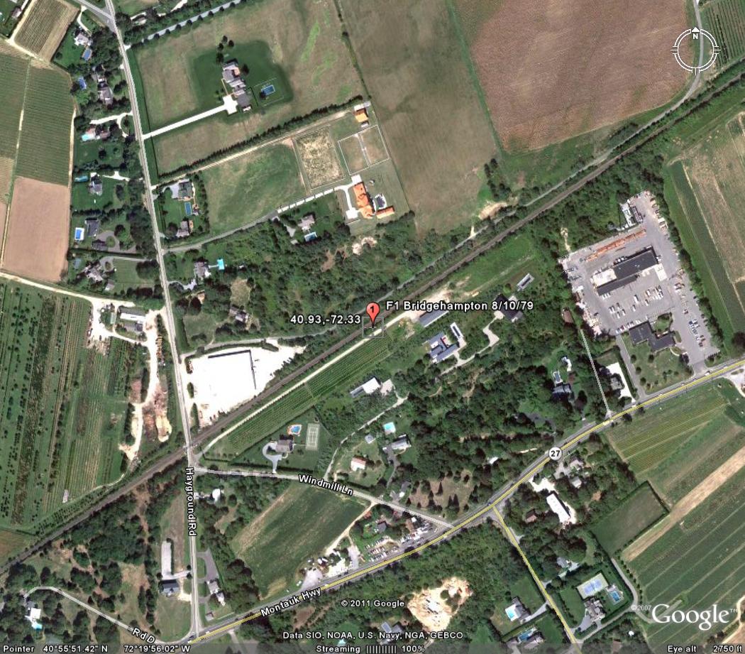
Bridgehampton August 10, 1979
Event: Tornado
Begin Date: 10 Aug 1979, 1445 CST
Length: 1.00 Mile
Width: 10 Yards
Magnitude: F1
Fatalities: 0
Injuries: 0
Property Damage: $ 0.0K
Crop Damage: $ 0.0
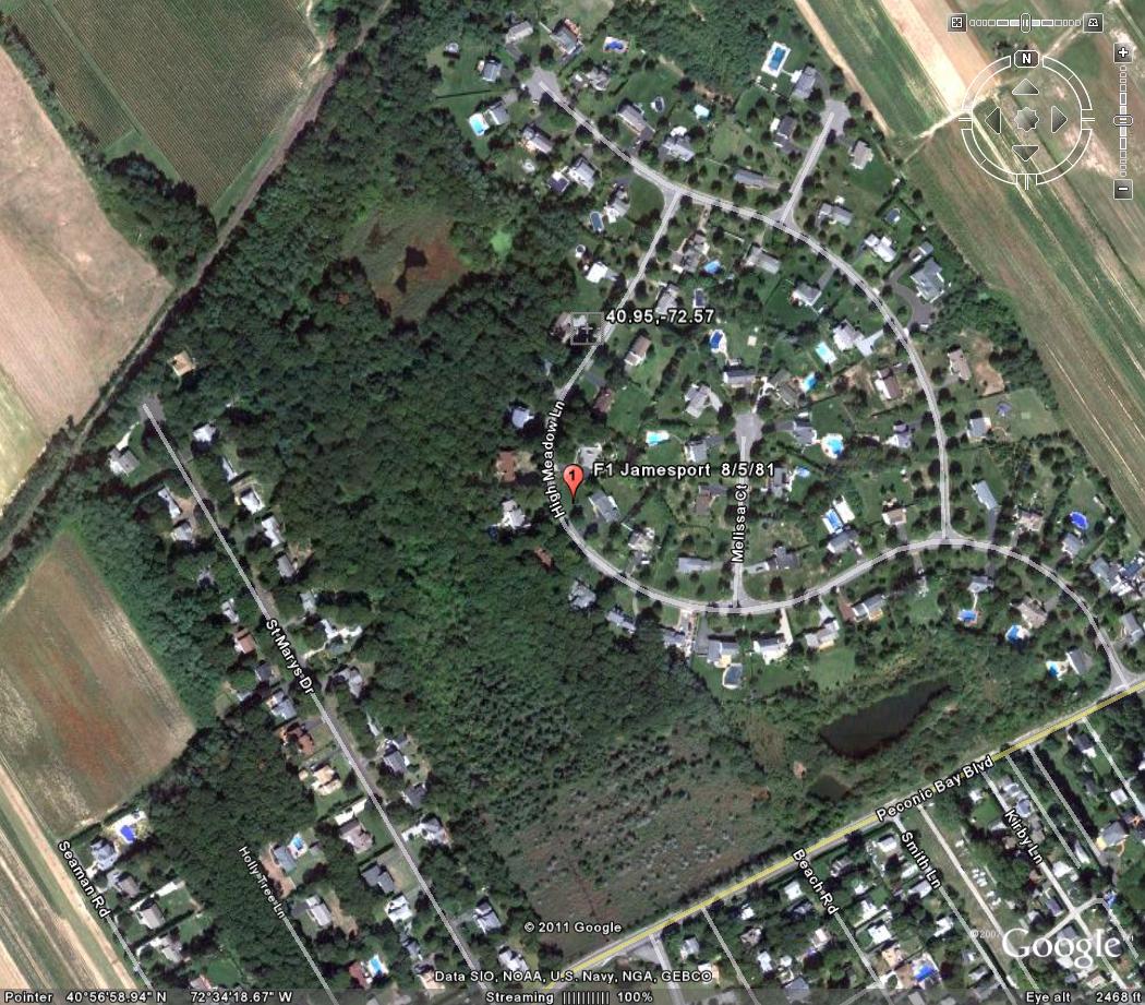
Jamesport August 5, 1981
Event: Tornado
Begin Date: 05 Aug 1981, 1115 CST
Length: 2.30 Miles
Width: 13 Yards
Magnitude: F1
Fatalities: 0
Injuries: 0
Property Damage: $ 250.0K
Crop Damage: $ 0.0
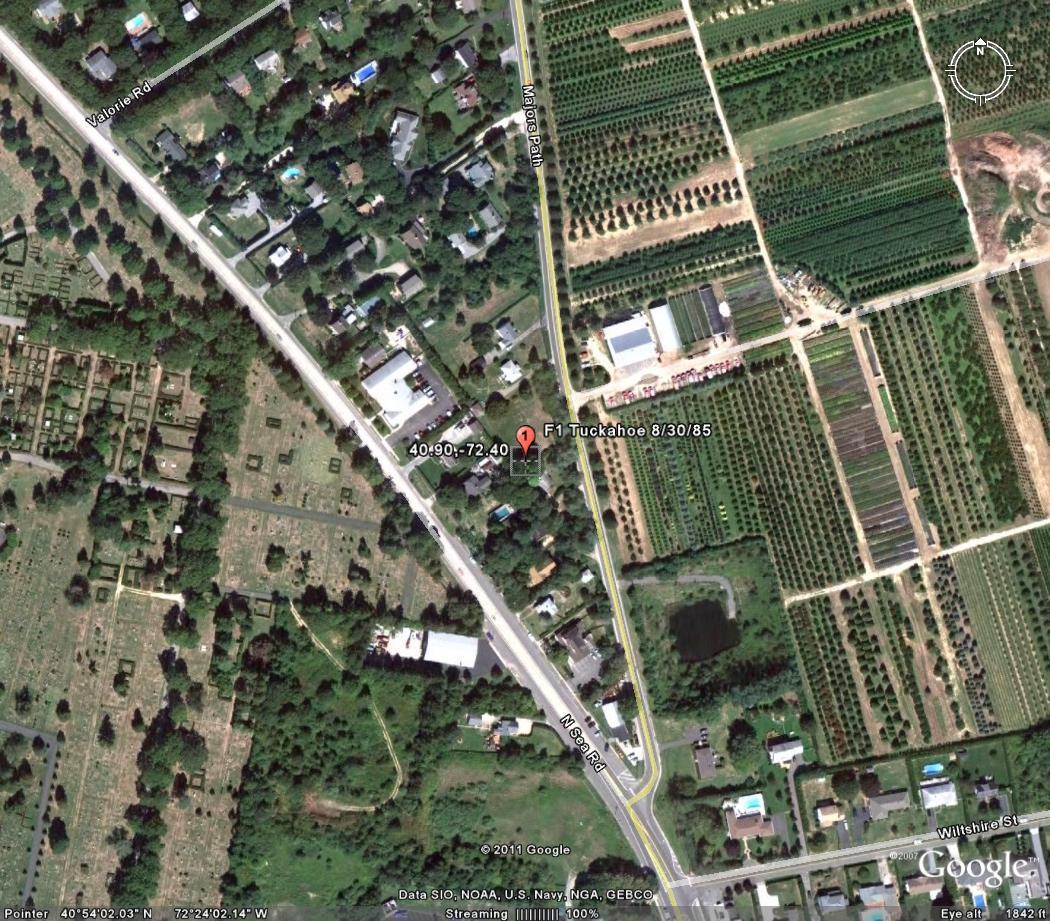
Tuckahoe August 30, 1985
Event: Tornado
Begin Date: 30 Aug 1985, 1030 CST
Length: 1.00 Mile
Width: 10 Yards
Magnitude: F1
Fatalities: 0
Injuries: 0
Property Damage: $ 0.0K
Crop Damage: $ 0.0
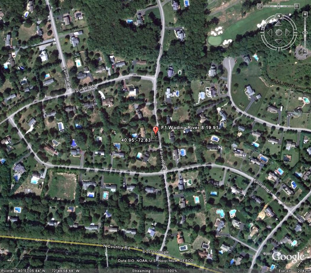
Wading River August 19, 1991
Event: Tornado
Begin Date: 19 Aug 1991, 1200 EST
Length: 0.20 Mile
Width: 100 Yards
Magnitude: F1
Fatalities: 0
Injuries: 0
Property Damage: $ 0.0K
Crop Damage: $ 0.0
Farmingdale July 23, 1995
Event: Tornado
Begin Date: 23 Jul 1995, 1730 EST
Length: 0.25 Mile
Width: 130 Yards
Magnitude: F1
Fatalities: 0
Injuries: 0
Property Damage: $ 0.0
Crop Damage: $ 0.0
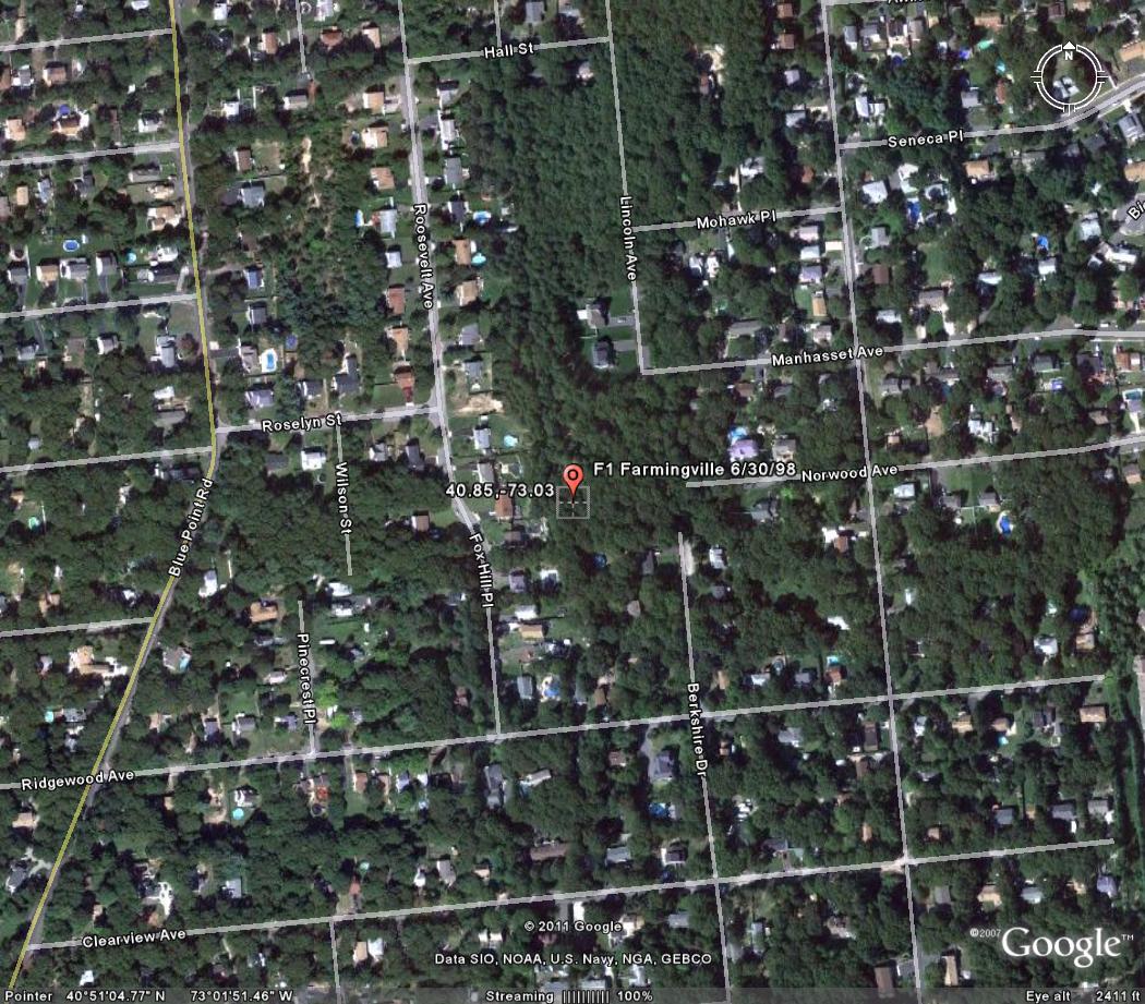
Lake Ronkonkoma June 30,1998
Event: Tornado
Begin Date: 30 Jun 1998, 07:15:00 AM EST
Begin Location: Lake Ronkonkoma
Begin LAT/LON: 40°50'N / 73°07'W
End Date: 30 Jun 1998, 07:15:00 AM EST
End Location: Lake Ronkonkoma
End LAT/LON: 40°50'N / 73°07'W
Length: 0.30 Mile
Width: 300 Yards
Magnitude: F1
Fatalities: 0
Injuries: 0
Property Damage: $ 0.0
Crop Damage: $ 0.0
On June 30th, two "waves" of severe weather occurred: the first during the morning and the second during the evening. The first wave included an isolated severe thunderstorm that spawned two weak tornadoes, large hail, and damaging winds as it moved across Central Suffolk County. The first tornado (F1) touched down along Lake Shore Road, south of Portion Road in Lake Ronkonkoma. It downed several large trees and power lines. Trees were blown into houses and caused structural damage. This tornado then lifted and funnel clouds were observed before another touchdown (F0) occurred on the campus of Suffolk Community College in Selden. Numerous trees were uprooted and fell on cars and wires on the campus. More tree damage occurred along Middle Country Road and Mooney Pond Road in Selden. The first wave also included a line of thunderstorms that moved east across Orange County. Thunderstorms produced high winds that downed trees in Goshen and Chester. A funnel cloud was also observed between Goshen and Chester. The second wave included lines of severe thunderstorms that produced high winds, large hail, and frequent lightning. This resulted in widespread damage across the region. In Orange County, high winds downed many trees and power lines. Significant damage to trees and houses occurred in Monroe and Newburgh. High winds also blew a trailer upside down on Bark Lane, off Big Island Road in Florida. Four people were injured and required medical treatment at Arden Hill Hospital. Lightning struck a house in Pine Bush, which ignited a fire and caused structural damage. In Rockland County, high winds downed power lines in New City and trees in Hillcrest and Stony Point. A tree fell into a hospital in Stony Point. In Westchester County, high winds downed trees in Peekskill and Yorktown. In Bronx County, hail damaged windows. In Queens County, high winds downed tree limbs that struck and injured 3 girls. One girl was seriously injured and required surgery. In Nassau County, 0.88-inch diameter hail fell in Jericho and 0.75-inch diameter hail fell in Oyster Bay. High winds downed trees and power lines. In Syosset, high winds blew off a roof from a house. In Suffolk County, an F1 tornado was confirmed in Mt. Sinai. The damage path extended from 114 Hickory Street to the corner of Marcy Drive and Westcliff Drive, then down Marcy Drive and across Chestnut Street. Several large trees were uprooted and damage to house shingles and roofs occurred along the path. Elsewhere in Suffolk County, high winds downed trees and power lines.
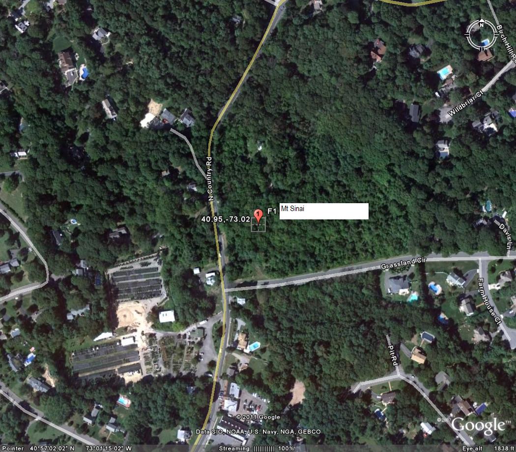
Mt. Sinai June 30,1998
Event: Tornado
Begin Date: 30 Jun 1998, 07:40:00 PM EST
Begin Location: Mt Sinai
Begin LAT/LON: 40°57'N / 73°01'W
End Date: 30 Jun 1998, 07:40:00 PM EST
End Location: Mt Sinai
End LAT/LON: 40°57'N / 73°01'W
Length: 0.30 Mile
Width: 75 Yards
Magnitude: F1
Fatalities: 0
Injuries: 0
Property Damage: $ 0.0
Crop Damage: $ 0.0
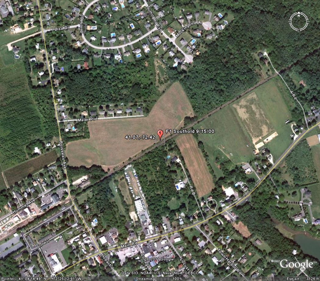
Southold September 15,2000
Event: Tornado
Begin Date: 15 Sep 2000, 05:20:00 AM EST
Begin Location: Southold
Begin LAT/LON: 41°04'N / 72°25'W
End Date: 15 Sep 2000, 05:20:00 AM EST
End Location: Southold
End LAT/LON: 41°04'N / 72°25'W
Length: 0.10 Mile
Width: 20 Yards
Magnitude: F1
Fatalities: 0
Injuries: 0
Property Damage: $ 0.0
Crop Damage: $ 0.0
As a line of thunderstorms and heavy showers moved southeast, one cell spawned a short-lived tornado in the town of Southold on the North Fork of Long Island. The National Weather Service conducted a storm survey and confirmed the occurrence of a weak tornado in the Nassau Point area of Little Hog Neck. This tornado was classified as an F1 with wind speeds estimated from 80 to 100 mph. The weak tornado first touched down in the back yard of three homes on the west side of Nassau Point Road around 6:20 am EDT. Then it moved through the front yard of one of the homes, where it did its' greatest damage. Most of the damage was to trees. Many trees had numerous branches twisted off and several trees were snapped off and deposited a good distance from where they grew. Slight structural damage was done to the roof of the house. The tornado crossed over to the east side of Nassau Point Road and apparently lifted as it moved across Hog Neck Bay. It touched down again in Bayview (on the other side of Hog Neck Bay) around 6:40 am EDT. Two eyewitnesses on Rambler Road experienced very strong winds, which uprooted trees and damaged several pieces of heavy lawn furniture. In this vicinity, the tornado was classified as an F0, with an approximate path length of 0.1 miles and average path width of 10 yards.
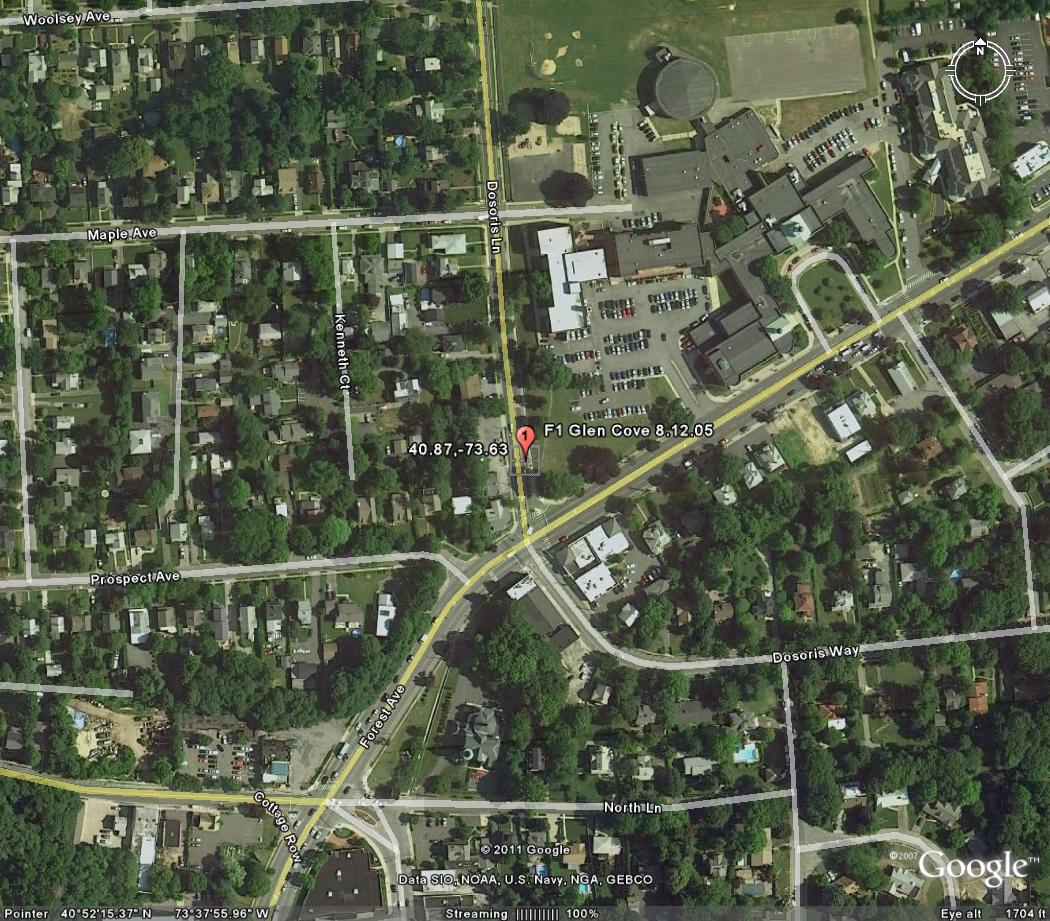
Glen Cove August 12, 2005
Event: Tornado
Begin Date: 12 Aug 2005, 08:45:00 PM EST
Begin Location: Glen Cove
Begin LAT/LON: 40°52'N / 73°38'W
End Date: 12 Aug 2005, 08:46:00 PM EST
End Location: Glen Cove
End LAT/LON: 40°52'N / 73°38'W
Length: 0.20 Mile
Width: 50 Yards
Magnitude: F1
Fatalities: 0
Injuries: 0
Property Damage: $ 135.0K
Crop Damage: $ 0.0
A weak and short-lived F1 tornado touched down around 945 pm EDT in Glen Cove. The tornado formed in a thunderstorm that formed on an outflow boundary produced by a line of thunderstorms over Long Island Sound. The tornado moved from northwest to southeast and was estimated to be on the ground for only a minute or two. However, it caused considerable damage to many of the large trees in the area. Many large trees in the neighborhood to the south of the Welwyn Preserve came down and did considerable damage to homes and property. Damage was reported as far southeast as North Shore University Hospital. There were no known injuries. A line of thunderstorms developed over the Lower Hudson Valley of NY on the evening of the 12th. As these thunderstorms progressed to the southeast, they produced wind damage. A brief tornado also touched down in Nassau County.
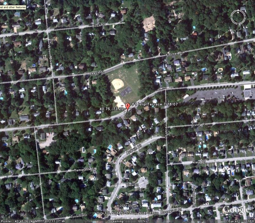
Islip Terrace July 18, 2007
Event: Tornado
Begin Date: 18 Jul 2007, 08:25:00 AM EST
Begin Location: Islip Terrace
Begin LAT/LON: 40°45'N / 73°12'W
End Date: 18 Jul 2007, 08:30:00 AM EST
End Location: Islip Terrace
End LAT/LON: 40°45'N / 73°12'W
Length: 1.00 Mile
Width: 150 Yards
Magnitude: F1
Fatalities: 0
Injuries: 0
Property Damage: $ 0.0K
Crop Damage: $ 0.0K
000
NOUS41 KOKX 190255 CCB
PNSOKX
CTZ005>012-NJZ002>006-011-NYZ067>081-191200-
PUBLIC INFORMATION STATEMENT
SPOTTER REPORTS
NATIONAL WEATHER SERVICE UPTON NY
1054 PM EDT WED JUL 18 2007
...NATIONAL WEATHER SERVICE METEOROLOGISTS CONFIRM EF1 TORNADO
TOUCHDOWN IN ISLIP TERRACE IN SUFFOLK COUNTY...
NATIONAL WEATHER SERVICE METEOROLOGISTS INVESTIGATING STORM DAMAGE
IN THE ISLIP TERRACE AREA WITH ISLIP EMERGENCY MANAGEMENT OFFICIALS
HAVE CONFIRMED THAT TORNADIC DAMAGE HAS OCCURRED IN THE AREA.
THE TORNADO PATH WAS DISCONTINUOUS AND STARTED IN THE TOWN OF ISLIP
TERRACE SOMETIME BETWEEN 9:20 AM AND 9:30 AM NEAR THE INTERSECTION
OF IRISH LANE AND THE NORTH SERVICE ROAD OF SUNRISE HIGHWAY. IT THEN
CONTINUED ABOUT TWO-THIRDS OF A MILE TO THE EASTNORTHEAST ACROSS
CARLETON AVENUE...ACROSS ROSLYN AND NASSAU STREETS AND ENDED AT
NASSAU AND KUNIGUNDA PLACE. THE PATH WAS NARROW AT FIRST...ONLY
AROUND 50 YARDS ACROSS NEAR THE INTERSECTION OF IRISH LANE AND THE
NORTH SERVICE ROAD OF SUNRISE HIGHWAY BUT FANNED OUT TO 150 YARDS
TOWARD THE END.
MOST OF THE DAMAGE WAS TO HARDWOOD TREES. TWISTED OFF BRANCHES WERE
EVIDENT THROUGHOUT THE DAMAGE PATH. SOME TREES WERE SNAPPED OFF
HALFWAY UP...INCLUDING SOME HEALTHY...FORTY-PLUS FOOT PINES.
IN ADDITION...THE MEDICAL ARTS BUILDING AT IRISH LANE AND SUNRISE
HIGHWAY SUSTAINED STRUCTURAL DAMAGE...WITH SIGNIFICANT LOSS OF ITS
ROOF COVERING AND THE HVAC UNIT BLOWN OFF ITS ROOF. OTHER HOMES
ALONG THE DAMAGE PATH ALSO SUSTAINED SOME MINOR DAMAGE MOSTLY TO
SIDING AND SOME DIRECTLY FROM TREES.
BASED ON THE DAMAGE THIS TORNADO IS CLASSIFIED AS AN EF-1 TORNADO
WITH ESTIMATED WIND SPEEDS OF 85 TO 100 MPH.
THE NATIONAL WEATHER SERVICE HAD ISSUED A SEVERE THUNDERSTORM
WARNING FOR THIS STORM AT 849 AM THAT WAS UPGRADED TO A TORNADO
WARNING AT 919 AM. THE TORNADO OCCURRED IN THE ISLIP TERRACE AREA
AROUND THE TIME THE TORNADO WARNING WAS ISSUED.
BULLETIN - EAS ACTIVATION REQUESTED
TORNADO WARNING
NATIONAL WEATHER SERVICE UPTON NY
919 AM EDT WED JUL 18 2007
THE NATIONAL WEATHER SERVICE IN UPTON NY HAS ISSUED A
* TORNADO WARNING FOR...
SOUTHWEST SUFFOLK COUNTY IN SOUTHEAST NEW YORK...
* UNTIL 945 AM EDT...
* AT 916 AM EDT...NATIONAL WEATHER SERVICE DOPPLER RADAR INDICATED A
SEVERE THUNDERSTORM CAPABLE OF PRODUCING A TORNADO NEAR SAYVILLE...
OR ABOUT NEAR ISLIP...MOVING NORTHEAST AT 10 MPH.
* THE TORNADO WILL BE NEAR...
SAYVILLE AND RONKONKOMA BY 940 AM...
HOLBROOK BY 945 AM...
WHEN A TORNADO WARNING IS ISSUED BASED ON DOPPLER RADAR...IT MEANS
THAT STRONG ROTATION HAS BEEN DETECTED IN THE STORM. A TORNADO MAY
ALREADY BE ON THE GROUND...OR IS EXPECTED TO DEVELOP SHORTLY. IF YOU
ARE IN THE PATH OF THIS DANGEROUS STORM...MOVE INDOORS AND TO THE
LOWEST LEVEL OF THE BUILDING. STAY AWAY FROM WINDOWS. IF DRIVING...DO
NOT SEEK SHELTER UNDER A HIGHWAY OVERPASS.
IF IN MOBILE HOMES OR VEHICLES...EVACUATE THEM AND GET INSIDE A
SUBSTANTIAL SHELTER. IF NO SHELTER IS AVAILABLE...LIE FLAT IN THE
NEAREST DITCH OR OTHER LOW SPOT AND COVER YOUR HEAD WITH YOUR HANDS.
LAT...LON 4076 7323 4070 7319 4075 7305 4082 7308
$$
GOODMAN
F2 TORNADOES
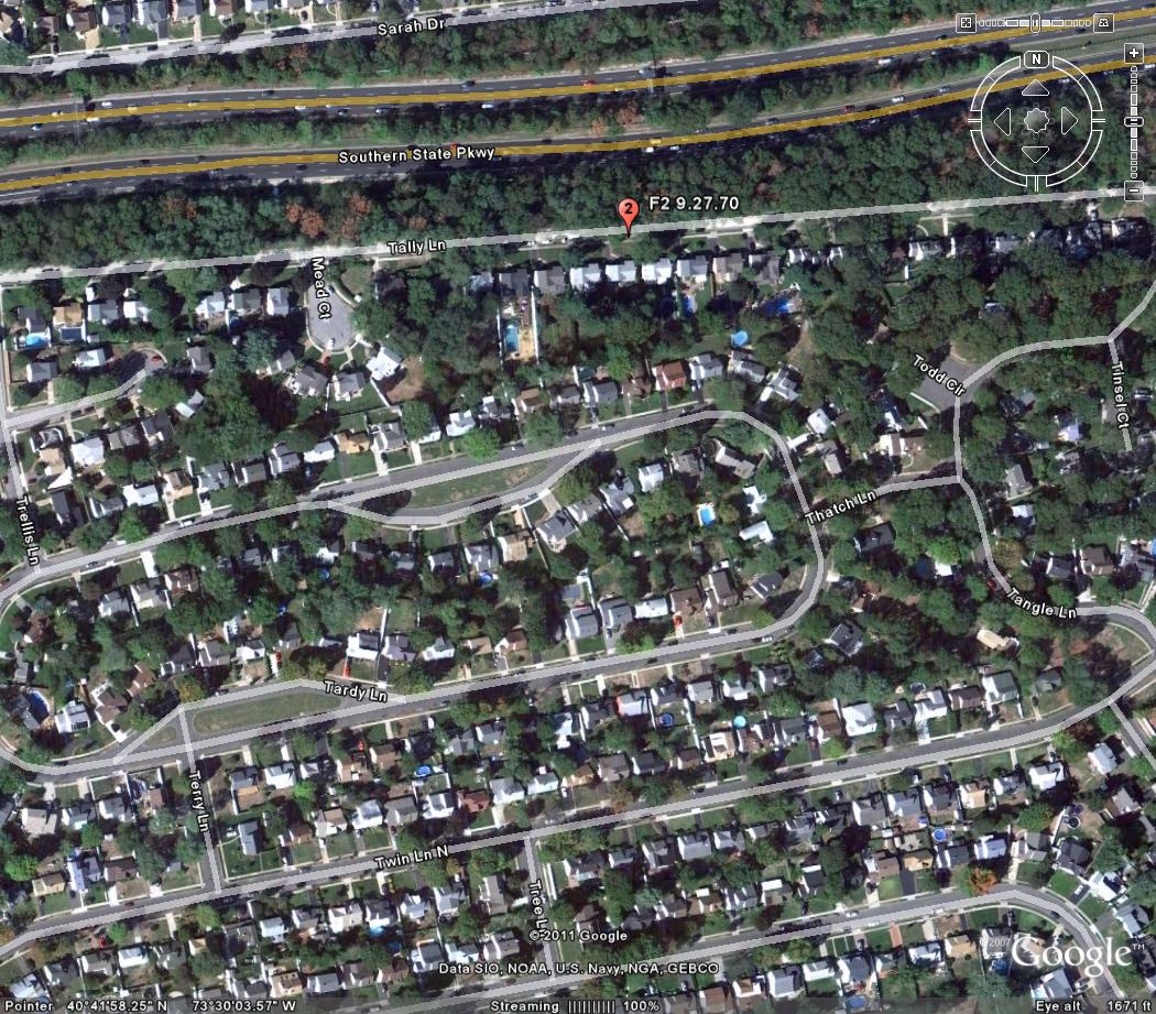
Wantagh September 27,1970
Event: Tornado
Begin Date: 27 Sep 1970, 1010 CST
Begin Location: Wantagh
Begin LAT/LON: 40°42'N / 73°30'W
End Location: Wantagh
Length: 0.50 Mile
Width: 77 Yards
Magnitude: F2
Fatalities: 0
Injuries: 0
Property Damage: $ 250.0K
Crop Damage: $ 0.0
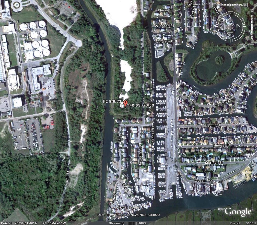
Seaford September 18, 1973
Event: Tornado
Begin Date: 18 Sep 1973, 0740 CST
Begin Location: Seaford
Begin LAT/LON: 40°39'N / 73°30'W
End Location: Seaford
End LAT/LON: 40°40'N / 73°27'W
Length: 1.90 Miles
Width: 167 Yards
Magnitude: F2
Fatalities: 0
Injuries: 0
Property Damage: $ 0.0K
Crop Damage: $ 0.0
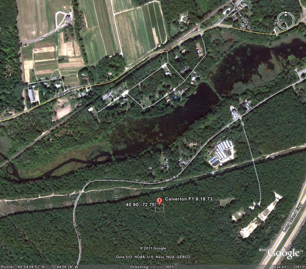
Calverton September 18, 1973
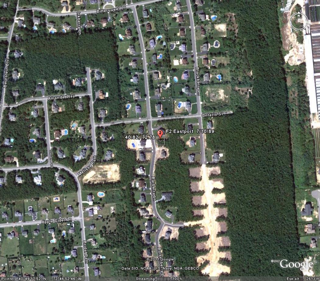
Eastport July 10,1989
Event: Tornado
Begin Date: 10 Jul 1989, 1715 CST
Length: 0.20 Mile
Width: 40 Yards
Magnitude: F2
Fatalities: 0
Injuries: 1
Property Damage: $ 0.0K
Crop Damage: $ 0.0
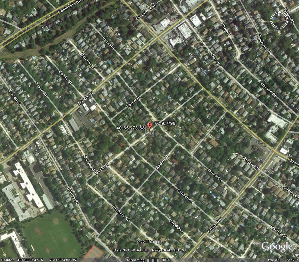
Lynbrook September 7, 1998
Event: Tornado
Begin Date: 07 Sep 1998, 01:55:00 PM EST
Begin Location: Lynbrook
Begin LAT/LON: 40°39'N / 73°41'W
End Date: 07 Sep 1998, 01:55:00 PM EST
End Location: Lynbrook
End LAT/LON: 40°39'N / 73°41'W
Length: 0.20 Mile
Width: 200 Yards
Magnitude: F2
Fatalities: 0
Injuries: 6
Property Damage: $ 1.0M
Crop Damage: $ 0.0
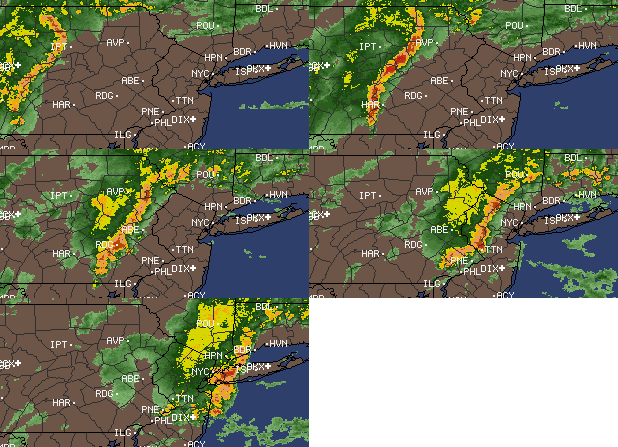
The NWS confirmed that an F2 tornado was responsible for significant damage that occurred in Lynbrook. Most of the village received damage from straight line winds up to 80 mph, that was associated with a severe squall line. Downed trees covered the village with some structural damage where the F2 tornado touched down. The major path of damage was from the northwest section of Lynbrook east-southeast to the southeast section of the village. Funnel clouds were observed from near the intersection of Marshall Ave. and Burtis Street and to the southeast. A tornado was first sighted by two eyewitnesses on Hampton Place. It rose and touched down several times: Second, near Winter Street and across Glover Circle; Third, along Peninsula Blvd. between Earle and Benton Avenues; and Fourth, as a weak F2 near the intersection of Rocklyn Ave. and Merrick Road. It moved across the Long Island Railroad Tracks and Sunrise Highway before it finally dissipated. More than three hundred trees were blown over, many on houses and cars. Six people received minor injuries. Four of these were in "The Fun Zone" on Rocklyn Avenue. One woman was slightly injured by a tree that fell on her car. One police officer was also injured. An intense line of severe thunderstorms oriented from north to south developed during Labor Day afternoon ahead of a strong approaching cold front. As the storms moved east at 40 to 50 mph, they produced high winds, large hail, and an isolated tornado. Wind gusts from 60 to 80 mph downed many trees and power lines throughout the area. The cost estimates of damage included above are preliminary figures submitted by the Nassau County Office of Emergency Management. In Richmond County, the following peak wind gusts were reported: 80 mph at Great Kills, the Verranzano Bridge, and in Richmond. High winds downed trees and caused a building to collapse in Richmond. One tree fell on and injured a man in Richmond. In New York County (Manhattan), high winds caused a building to collapse. In the Bronx, high winds downed a tree that fell on 3 people resulting in 1 death and 2 injuries in the courtyard of the Edenwald Houses at 1135 East 229th Street. In Kings County (Brooklyn), high winds downed and uprooted several large trees. One tree fell on and injured a person at East 229th Street. Five to 6-foot diameter trees were uprooted east of Coney Island in the Gerritsen Beach Section, where 3 funnel clouds were also sighted and a firefighter was injured from large hail. Large trees also fell on and damaged cars in Bensonhurst. In Queens County, a peak wind gust of 62 mph was measured at both LaGuardia Airport and at JFK Airport. In Nassau County, the following peak wind gusts were reported: 75 mph in Farmingdale, 60 mph in Port Washington and Mineola and 58 mph at Farmingdale Republic Airport. High winds downed large tree limbs at Rockville Center, Baldwin, and Oceanside and downed trees in Long Beach, Massapequa, and Valley Stream. One-inch diameter hail dented cars and covered the ground in Farmingdale. In Suffolk County, high winds overturned many boats in the Great South Bay, downed large trees in West Babylon and Rocky Point and downed large tree limbs in Wading River. One person died when a thunderstorm wind gust capsized a 19 foot sail boat in Great South Bay near Copiague. A Centerport woman, 36, and her daughter, 3, were injured when a tree fell on them in the parking lot of the Ground Round Restaurant and CVS on Fort Salonga Road. The following peak wind gusts were reported: 72 mph in Babylon and 65 mph in Fire Island
Gov. Pataki was prepared to declare the Village of Lynbrook an emergency disaster area in the wake of Monday's sudden and violent storm, Long Island Power Authority Chairman Richard Kessel said yesterday.
Lynbrook Mayor Eugene Scarpato appealed for the designation in the aftermath of the storm, which downed power lines and trees and caused extensive damage to several homes and businesses.
"It's terrible," said Scarpato, describing the damage.
Lynbrook would be eligible for state cleanup aid if it were designated an emergency disaster area.
Scarpato surveyed damage in the 3-square-mile village as meteorologists from the National Weather Service conducted their own survey to determine whether a tornado had touched down in Lynbrook.
Yesterday afternoon, meteorologist Mike Wyllie confirmed that there were several small tornadoes during Monday's storm. He classified them as F0 and F1 the weakest tornadoes with wind speeds between 70 mph and 110 mph. F5 is the strongest tornado classification.
"For a brief period, they touched down for a few hundred yards at a time," he said.
However, Wyllie said, the big trees downed in the storm were felled by "straight-line winds," not the tornadoes.
Tornadoes hit Lake Ronkonkoma and Seldin in the spring, but are still considered rare on Long Island.
"Obviously, it looked like one and smelled like one," said Scarpato, after hearing the tornado confirmation.
In the afternoon, Scarpato and other village officials met with Nassau County Executive Thomas Gulotta and Kessel to discuss the cleanup effort.
The mayor and village trustee Thomas Miccio gave Kessel a list of streets where homes were still without power. Miccio said 80% of Lynbrook homes lost power. As of yesterday morning, 40% were still in the dark. Lynbrook has a population of 21,000.
Kessel said 120,000 homes throughout Long Island lost power after the storm hit, uprooting trees and toppling power lines, and that power had been restored to 103,000 homes by noon yesterday. He said special attention was being given to Lynbrook because of the extent of damage there.
Lynbrook students got an extra day of summer vacation as schools were closed. They were expected to be open today.
One of the hardest-hit businesses was Sportime, an indoor tennis and health spa on Merrick Road, where a brick wall collapsed. Sportime had been closed for the past year for renovations.
"It was going to open today," said Lee Rae Mackey, 42, an employee. "They spent a fortune. It's one of those things. Who knew? A brick wall."
Nassau Legislator Francis Becker (R-Lynbrook) narrowly avoided injury when a tree limb crashed into his garage during the storm.
Yolanda Ingorgia, 75, took a tour of her neighborhood yesterday afternoon.
"I can't say it was nothing because it was something," she said. "I knew it was a tornado because I saw it spinning like crazy
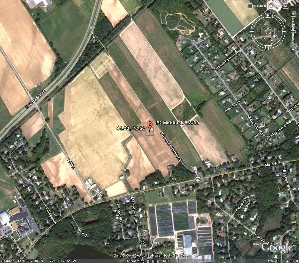
Mattituck August 8, 1999
Event: Tornado
Begin Date: 08 Aug 1999, 07:28:00 AM EST
Begin Location: Mattituck
Begin LAT/LON: 41°00'N / 72°31'W
End Date: 08 Aug 1999, 07:40:00 AM EST
End Location: New Suffolk
End LAT/LON: 41°00'N / 72°28'W
Length: 4.00 Miles
Width: 300 Yards
Magnitude: F2
Fatalities: 0
Injuries: 1
Property Damage: $ 1.0M
Crop Damage: $ 0.0
A cluster of severe thunderstorms formed north of an approaching strong warm front and moved east-southeast, just north of the front. A severe thunderstorm produced a tornado along the south shore of the North Fork of Suffolk County on Long Island. The tornado touched down and lifted several times along a 4 mile path as it moved east-southeast from just southeast of Mattituck Air Base, across Marratooka Pt., Kimogener Pt. (of New Suffolk), Cutchogue Harbor, Central Nassau Pt., then lifted as it crossed Hog Neck Bay. The National Weather Service Survey showed that the tornado touched down first in southern sections of Mattituck. This was in the backyard area bounded to the west by Marratooka Road, to the north by Center Street, and to the south by Park Ave. Most damage at this location was to trees, where many tops were twisted off and several snapped off at 5 to 15 feet above the ground. This was estimated as F1 damage. The tornado "bounced" and continued east to the dirt road extension of Park Ave., where it lifted the roof off a cottage at #520. The roof of the building detached from the house and was carried about 115 feet to the northeast. The tornado continued east for about 1/2 mile, then touched down again at 10 Kimogenor Point. It ripped off the porch and part of the main roof of the house. It apparently developed a few separate vortices at this location. One twisted a 100 year old metal windmill over high tension power lines and did some significant damage to large trees. Another vortex slammed into the front porch at 2 Kimogenor Point. It ripped off the porch and a large section of the roof of the house. The lone inhabitant said he saw a "wall of water" heading toward his house and instinctively dove into the stone fireplace to protect himself as the storm hit. Winds were estimated over 100 mph over this part of the tornado's path. The tornado continued east along Jackson Ave. causing havoc with many mature trees in the area. The most significant damage occurred in the vicinity of Jackson Ave. and Fifth Street, where winds were estimated from 110 to 120 mph, due to the devastation to many large trees. This was the area where F2 damage was observed. This was also the widest path width, which was estimated at 300 yards. The tornado continued east along Jackson Ave. creating F1 damage then went over Cutchogue Harbor. Eyewitnesses from Nassau Point (Little Hog Neck) said they saw the tornado over the water just east of New Suffolk. They saw several suction vortices rotating around the main funnel. The tornado moved across Nassau Point, in the vicinity of Wunnaweta Pond, where it twisted and sheared off many trees that fell on and damaged houses. It bounced again and hit close to the ground near #6225 and #6325 Nassau Point Road. Many trees fell onto and damaged homes. These backyards were on top of a cliff overlooking Hogs Neck Bay. The tornado lifted before hitting these homes. This was the last indication of tornadic damage. The latest cost estimates of damage from the Southhold Supervisor's Office are in excess of $1 million dollars. One injury occurred as a person was struck by flying debris
Roaring like a runaway train, a tornado raged irregularly yesterday along four miles of shore and harbor on Long Island's Great Peconic Bay. It tore roofs and porches off several houses, flattened hundreds of trees, sank or damaged 20 boats, crushed a picturesque old windmill, left thousands of homes without power and terrified those who saw it.
In a 15-minute rampage along the North Fork in Suffolk County, the twister -- a towering whirl up to 300 yards wide, with winds estimated by National Weather Service at 73 to 155 miles an hour -- touched down at 8:25 A.M. at Mattituck, then hopscotched to New Suffolk, Cutchogue Harbor and Nassau Point.
Refrences
thetornadoproject.com
wunderground.com
National Climatic Data Center
Youtube
google earth
bing.com
google.com
nws upton ny
