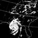
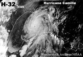
Hurricane Camille was the third tropical cyclone and second hurricane of the 1969 Atlantic hurricane season. At peak intensity, Camille was a Category 5 hurricane that struck the United States near the mouth of the Mississippi River on the night of August 17, causing catastrophic damage. Camille was the only hurricane with official winds reported to reach at 190 mph until Allen in 1980.
Formed August 14, 1969
Dissipated August 22, 1969
Highest winds 190 mph (305 km/h) (1-minute sustained)
Lowest pressure 905 mbar
Damages $1.42 billion (1969 USD)
$9.14 billion (2005 USD) [3]
Fatalities 259 direct
Areas affected Cuba, Alabama, Mississippi, Louisiana, Southern United States (particularly major flooding in Virginia
On the night of August 17, 1969 Hurricane Camille hit the Mississippi Gulf Coast. Many had scoffed at the forecast of unprecedented high winds and expected a rising tide, but in the early morning hours of August 18th were firm believers. Final data on the storm reported wind velocity in excess of 210 miles per hour and a tidal surge in excess of 24 feet topped with at least a 10 foot sea. Many of those who refused to believe the forecast and stayed at home to ride out the storm lived to regret it. Some did not live through it. The latest survey reveals l34 deaths; 27 missing; 8,931 injured; 5,662 homes destroyed and 13,915 suffering major losses. This is not counting the loss of businesses, other structures, and much of the natural beauty of the Mississippi Coast. The total destruction area of Harrison County alone was 68 square miles. Because of ample warning the death toll was not as high as in some previous hurricanes, but the destruction was unprecedented in United States history to that time.


